About Touch GIS
Touch GIS is a professional-grade field data collection and visualization tool powering advanced, intuitive, and flexible mapping. Powerful mobile devices are transforming how we work in the field. Touch GIS takes full...
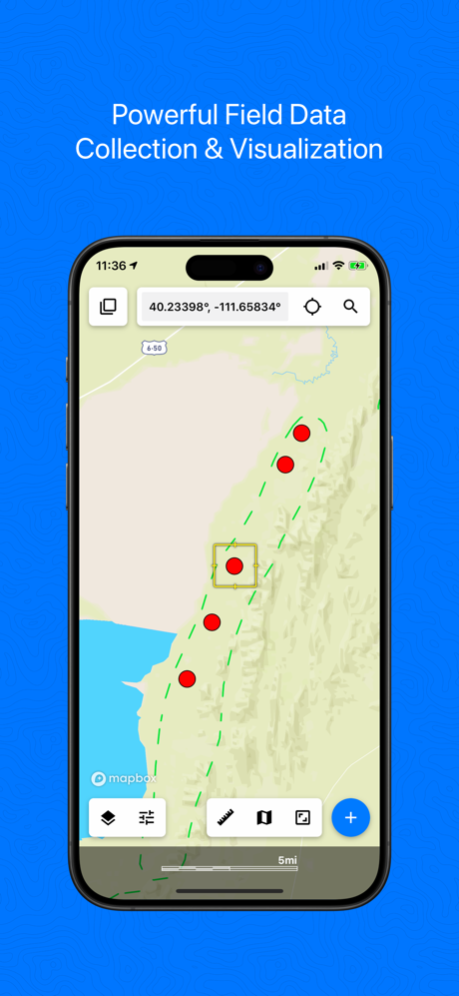
Touch GIS is a professional-grade field data collection and visualization tool powering advanced, intuitive, and flexible mapping.
Powerful mobile devices are transforming how we work in the field. Touch GIS takes full advantage of these devices to make field data collection and mapping easier than ever before. Join thousands of professionals utilizing Touch GIS to amplify their work in geological mapping, ecological mapping, mineral exploration, residential and commercial development, and more.
FEATURES
- Intuitive Interface
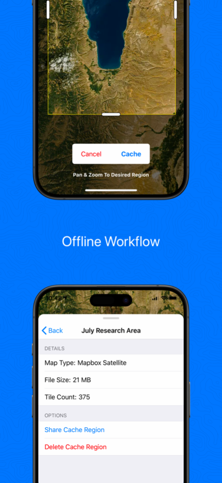
- Offline Capabilities
- Map Caching
- Robust File Support
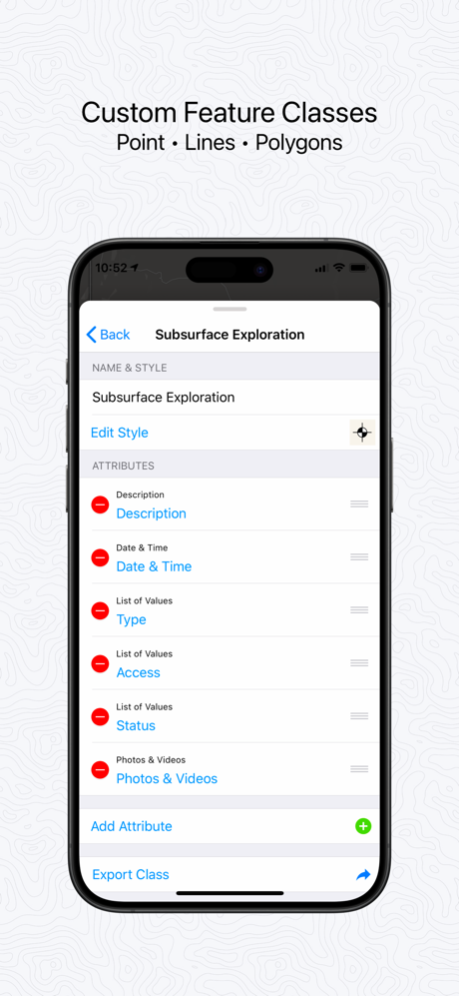
- Customizable Attribute Forms
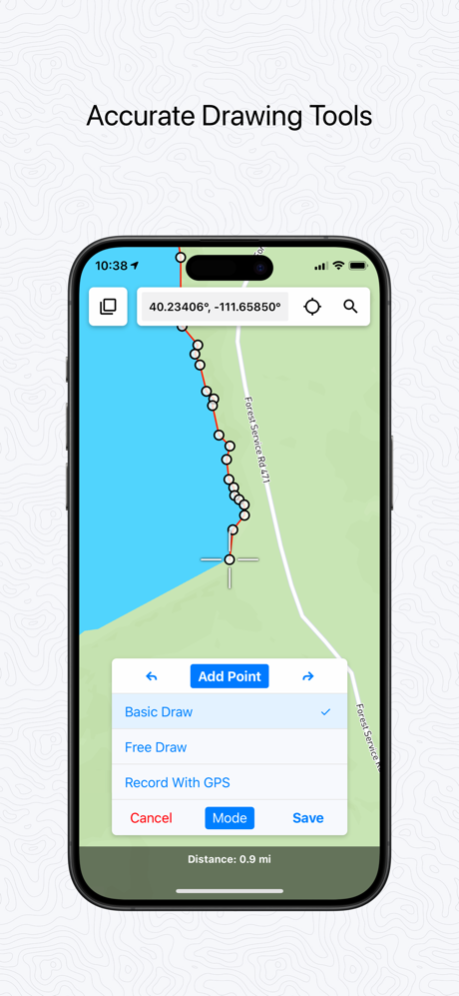
- Point, Line, Polygon, and Circle Features
- Custom Feature Classes
- Preloaded Feature Class Templates
- WMS/WMTS Support
- Raster Image Support
FILE TYPES SUPPORTED
- Shapefile
- KML/KMZ
- GeoJSON
- GPX
- CSV (Export)
- World File
- Geotiff
CUSTOM FORMS
- Description
- Date & Time
- Photo
- List Of Values
- Checkbox
- Address
- Number
- Website
- Phone Number
PRELOADED FEATURE CLASSES
- Forestry
- Geology
- Real Estate
- Stream Surveys
- Water Infrastructure
- Wetlands
- Create Your Own!
Terms of Service: https://www.touchgis.app/terms-of-service
Privacy Policy: https://www.touchgis.app/privacy
Apr 25, 2024
Version 1.5.9
Fixes a bug which prevented users from activating their purchased subscription.
Previous Versions
Here you can find the changelog of Touch GIS since it was posted on our website on 2021-12-14 09:03:30.
The latest version is 1.5.9 and it was updated on 2024-04-27 11:36:22. See below the changes in each version.
Touch GIS version 1.5.9
Updated At: 2024-04-25
Changes: Apr 25, 2024
Version 1.5.9
Fixes a bug which prevented users from activating their purchased subscription.
Touch GIS version 1.5.8
Updated At: 2024-04-17
Changes: Apr 17, 2024
Version 1.5.8
Fixes:
- Prevent crashes when opening a recently imported project
- Intermittent errors preventing users from logging in
Touch GIS version 1.5.6
Updated At: 2024-03-29
Changes: Mar 29, 2024
Version 1.5.6
Minor bug fixes and optimizations.
Touch GIS version 1.5.5
Updated At: 2023-05-08
Changes: May 8, 2023
Version 1.5.5
- Fix issue with exporting csv files
Touch GIS version 1.5.4
Updated At: 2023-04-24
Changes: Apr 24, 2023
Version 1.5.4
- Added ability to copy a list of value options from an existing attribute
- Other bug fixes and optimizations
Touch GIS version 1.5.3
Updated At: 2023-03-22
Changes: Mar 22, 2023
Version 1.5.3
- Added link to the account screen to manage team subscriptions.
- Fixed crash when opening a project that had a folder with no features and the feature class had been deleted.
Touch GIS version 1.3.5
Updated At: 2020-08-06
Changes: Aug 6, 2020 Version 1.3.5
- Added Lateral Offset for GPS Drawing (enable in Map Settings)
- Fixed issue occurring when moving layer data
- Added ability to possibly recover corrupted data
- Removed unnecessary quotations marks from CSV export
Disclaimer
Official App Store Link
We do not host Touch GIS on our servers. We did not scan it for viruses, adware, spyware or other type of malware. This app is hosted by Apple and passed their terms and conditions to be listed there. We recommend caution when installing it.
The App Store link for Touch GIS is provided to you by apps112.com without any warranties, representations or guarantees of any kind, so access it at your own risk.
If you have questions regarding this particular app contact the publisher directly. For questions about the functionalities of apps112.com contact us.